Neuigkeiten
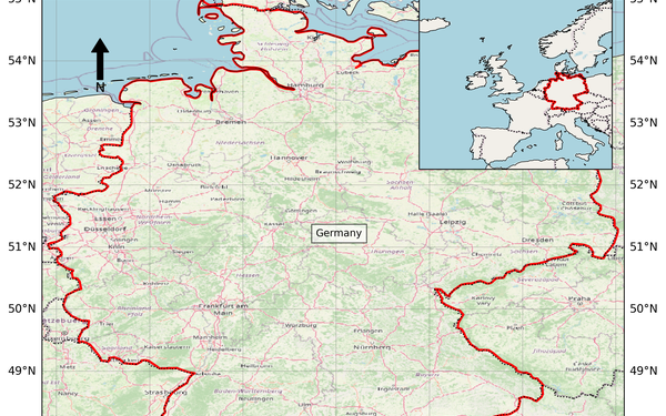
Study Area Map Generator: A Web-Based Shiny Application for Generating Country-Level Study Area Maps for Scientific Publications
Do you need a study area map for your article or report but don’t want to spend time creating this classic figure from scratch? With our free online application, you can generate your study area map quickly and easily in just a few minutes by visiting https://cesarivanalvarez.shinyapps.io/country-map/. This tool has been published as a scientific article: https://shorturl.at/JbXe6
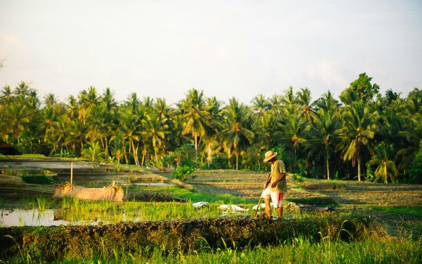
The role of multiple cropping in sustainable and resilient land use and food production
Read our latest research on multiple cropping, published with Springer Nature in Communications Earth & Environment.
(Photo Credit: Daniel Stiel, unsplash)
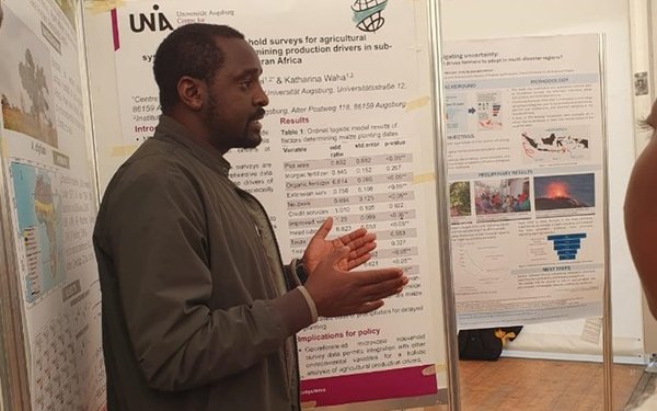
Reconciling land system changes with planetary health, Tropentag 2025
Dr. Harison Kipkulei attended the Tropentag 2025 Conference in Bonn, Germany, from 10–12 September.
(Photo Credit: Irene Kadzere)
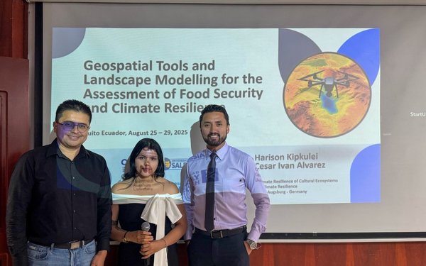
Geospatial tools and landscape modelling for the assessment of food security and climate resilience: Course held in Quito, Ecuador
Cesar Ivan Alvarez and Harison Kipkulei, from the Research Group for Climate Resilience, taught the bilingual course “Herramientas geoespaciales y modelado de paisajes para la evaluación de la seguridad alimentaria y la resiliencia climática” in Quito, Ecuador (August 25–29). Supported by CEDIA/Fondo Avante, the training strengthened Ecuadorian researchers’ geospatial capacities.
(©U.P. S.)
We are hiring
There is a position available in our research group for a Research Scientist (Foresighting resilient adaptation and land use change) from November 01st 2025
Global Tipping Points Conference 2025

Available places at the course "Optimizing Work with AI: A Practical Approach"

Open up commercial satellite image archives

New research scientists at the Research Group

Global Land Programme 5th Open Science Meeting

Die Klimawoche für alle an der Universität Augsburg
Die Universität Augsburg ist vom 04. bis 08. November 2024 Teil der Public Climate School. Bei dieser Initiative öffnen Forschungseinrichtungen in ganz Deutschland ihre Räume für die Öffentlichkeit und vermitteln wissenschaftlich fundiertes Wissen rund um die Klimakrise. In Augsburg stehen Planspiele, Vorträge, Filmvorführungen und interaktive Formate auf dem Programm.

2024 EO for Africa Symposium
Harison Kipkulei presented a talk at the 2024 Earth Observation (EO for Africa Symposium) which took place in Frascati, Italy.
